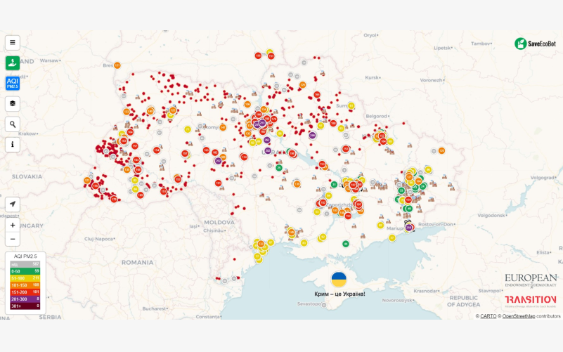
On 26 March, Friday, our SaveEcoBot showed the disappointing statistics: about 5,600 fires and—on Sunday—as many as 15,000 fires in Ukraine! We receive these data from FIRMS (NASA) and display the fires as separate points on the pollution map. But sometimes, due to heavy clouds, the satellites can’t detect all the fires we now see in Western Ukraine. Consequently, the real statistics can be even more frightening.
But the thing is that these painful red points on the map aren’t about ‘bad government or oligarchs’. These are the consequences of your neighbours burning reeds or plant litter, throwing a cigarette in the dry grass, or leaving the coals to smoulder after a picnic. This way, hundreds of hectares of fertile soil get destroyed, animals die, and inhabitants of surrounding areas, including violators, breathe dangerous air.
We urge everyone to stand up for the good:
- Instead of burning, compost or give vegetable waste to your neighbours who will feed it to their cattle!
Here’s a reminder for those who support common sense:
- If your neighbours break the law, including environmental ones, call the police!
They’ll do pay fines—from a few hundred to tens of thousands of hryvnias—and that’s good. But unless our society has a critical mass of prudent and caring citizens, Ukraine will be covered with red points every spring, suffering from human stupidity and irresponsibility. Spread common sense by sharing this information with your friends.