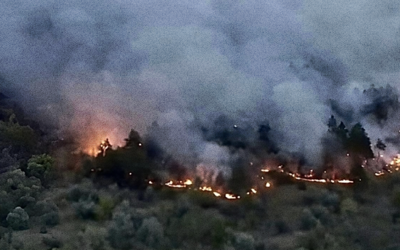
The need to analyse Ukraine’s environmental condition — for example, tree cover in particular regions or air quality — has existed for a long time. Since Russia’s full-scale invasion, this ‘inventory’ has also become necessary to understand the current environmental situation, help affected people and build historical datasets.
Through the EMITTER project, the analytical platform VoxUkraine initially focused on developing environmental recommendations from collected indicators to assess their environmental effects. From 2022, however, its tasks changed with the times. The focus shifted to analysing the effects of Russia’s terrorist actions on natural resources, farmland, forests and infrastructure.
Stage 1: When action must be immediate
Collecting data while circumstances change extremely rapidly requires determination and an immediate response. Russia’s destruction of the Kakhovka Hydropower Plant forced VoxUkraine to decide quickly: having assessed infrastructure destruction before, the team would take on this task too.
This unprecedented tragedy required entirely new approaches to recording and assessing damage. The team therefore began developing a comprehensive methodology accounting for environmental and infrastructure changes.
It identified 60,507 flooded facilities covering 8.5 million m2. These were classified by facility type, degree of flooding — complete, partial or possible — settlement and other criteria.

The VoxUkraine team also joined the Ministry of Infrastructure’s crisis response mission to the affected region, taking on information work: daily reports, surveys of local administrations and organising requests for assistance.
The work identified differences between building damage caused by fighting and flooding. One of the most significant was that floods, unlike shelling, caused much greater damage to basements regardless of the water level.
Tools used:
- Azensus Vision’s technical resources to create a database of flooded buildings and structures
- satellite imagery provided by partners
Results:
- visualising the disaster’s consequences to plan response and infrastructure recovery through a BI dashboard of flooding caused by the Kakhovka Hydropower Plant’s destruction
- findings incorporated into the methodologies of the Kyiv School of Economics (KSE) and the international Post-Disaster Needs Assessment (PDNA), and the work of the Ministry of Economy and Ministry of Infrastructure
- calculating losses from collected data: the dam’s destruction caused more than a billion dollars in housing sector damage
- an event on the environmental consequences of the attack on the Kakhovka Hydropower Plant, organised with SaveDnipro
- cooperation with local administrations, international partners and experts enabled agreement on methodologies for damage assessment and their adaptation to existing conditions, laying the foundations for planning recovery and assistance to affected communities
Stage 2: What is happening near the centre of events?
A tragedy on the scale of the Kakhovka dam’s destruction has already had many devastating environmental consequences and will continue to do so.
VoxUkraine therefore faced a new challenge: look around and examine what had happened to nature near the Kakhovka Reservoir and on Dzharylhach Island.
The study covered parts of Kherson, Mykolaiv, Zaporizhzhia and Dnipropetrovsk regions. Its findings clearly demonstrated the effects of military action on Ukraine’s environment: ecosystems are rapidly becoming impoverished and even collapsing. Plants are increasingly dry and damaged, water resources are deteriorating, and the number of damaged sites keeps growing.

Left: NBR affected areas in 2022; right: NBR affected areas in 2023
VoxUkraine’s research used two main indicators:
- NDVI (Normalized Difference Vegetation Index), classifying vegetation cover as ‘No vegetation’, ‘Poor vegetation cover’, ‘Medium vegetation cover’ and ‘High vegetation cover’.
- NBR (Normalized Burn Ratio), used to identify burned surfaces and assess fire severity as ‘Highly affected areas’, ‘Moderately affected areas’, ‘Slightly affected areas’ and ‘Unaffected areas’.
Tools used:
- cooperation among stakeholders, including KSE and the Ministry for Communities and Territories Development
- Azensus Vision’s technical resources to create a database of vegetation changes in affected areas
- satellite imagery provided by partners
Results:
- visualising vegetation condition in areas adjoining the Kakhovka Reservoir on a BI dashboard
- comparing NDVI and NBR indicators with geospatial data across more than 40,000 km2
Stage 3: What is happening in other ecosystems?
VoxUkraine’s earlier work showed that assessing harm to Ukraine’s forest ecosystems also required attention.
Preliminary data indicates that military action has already destroyed more than 59 hectares of such areas. Other impacts include:
- forest fires
- pollution from munition explosions and destruction of infrastructure
- soil disturbance, erosion and degradation of forest landscapes from military vehicle movements and construction of fortifications
- mass deaths of wildlife forming part of forest ecosystems
The analysis used imagery from peak vegetation periods — July and August 2021–2023 — in Kyiv, Sumy, Kharkiv and Chernihiv regions. It also relied on NBR and NDVI indices.

NDVI affected areas in 2023
This identified areas with active burning or vegetation drying. Besides hostilities, these changes can also result from drought, harvesting and climate change.
Tools used:
- Azensus Vision’s technical resources to create a forest ecosystem database
- satellite imagery provided by partners
Results:
- visualising forest ecosystem condition in Kyiv, Sumy, Kharkiv and Chernihiv regions on a BI dashboard
- analysing more than a million hectares of Ukrainian forest ecosystems
- the research was presented at a workshop (event programme and VoxUkraine presentation) on addressing the war’s environmental impacts in Ukraine, held on 1–3 May 2024. Participants included the Verkhovna Rada, Ukraine’s Ministry of Economy, the State Agency for Restoration and Infrastructure Development, the Ministry of Agrarian Policy, the National Academy of Sciences of Ukraine, the US National Academy of Sciences, the US State Department, USAID, UNDP, the World Bank and research centres.
Will the project continue?
The project’s main work is now complete. It documented conditions in particular areas during 2022–2023. The dashboards are not currently being updated but remain publicly accessible.
VoxUkraine sees two possible paths: these online tools, together with published comprehensive damage assessment reports, could provide a substantial basis for future research; or the project could continue, bringing updated information to the dashboards.
Either way, foundations have been laid for further damage assessments and methods for restoring affected areas.
This publication was produced with financial support from the European Union through the EMITTER project. Its contents are the sole responsibility of SaveDnipro and do not necessarily reflect the views of the European Union.